What to Do When Snow Affects Your Inventory Plan
Mother Nature doesn’t always consider your inventory measurement plans when formulating disruptive weather such as snow and wind. Yet monthly inventory counts must go on. Lets dive into how we respond.
How Do I Know if Snow Affected My Measurement?
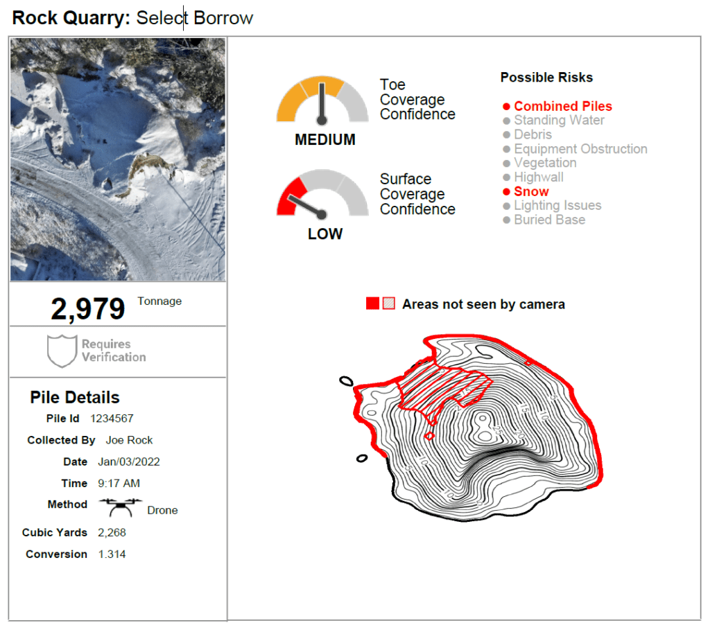
Snow is like any other measurement risk. Stockpile Reports identifies the risks in each measurement, independently evaluating more than a dozen common problems corrupting the accuracy of a stockpile measurement. If a measurement is not sufficient because of snow cover, we will tell you. We require manual verification and resolution of problematic conditions when risks such as snow are detected before we issue a report.
Why Does Snow Affect My Measurement Quality?
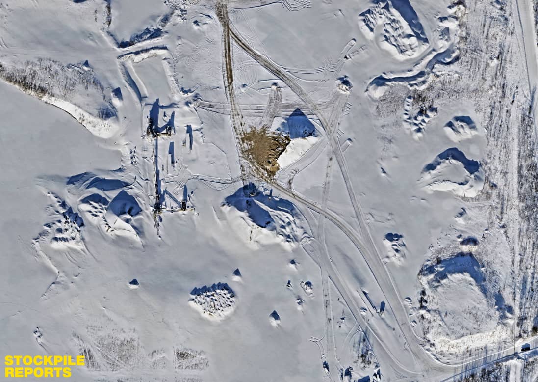
Heavy snow cover on stockpiles, especially fresh or windblown snow, leads to texture-less surfaces, a modeling challenge for any photo-based 3D technology. Stockpiles need unique visual features to be converted into a measurable 3D model. Fresh, white snow is completely devoid of unique features, leading to gaps in the measurement data (we mark these risk areas on stockpiles in red on measurement reports). In some cases, when no texture is captured over an entire stockpile, we are unable to produce a measurement report.

How Do I Minimize Risk Due to Snow?
The first option is to wait for snow to melt and pile surface to become visible. If you can’t wait for the snow to melt, assess whether the snow surface is fresh, dirty, or partially covering the stockpile. If you have fresh snow without any visible surface texture you following options are:
- Use equipment to move the snow off of the stockpile
- Throw small rock or sand across the surface of the stockpile to add texture

Can I Use a Measurement Report with Identified Snow Risk?
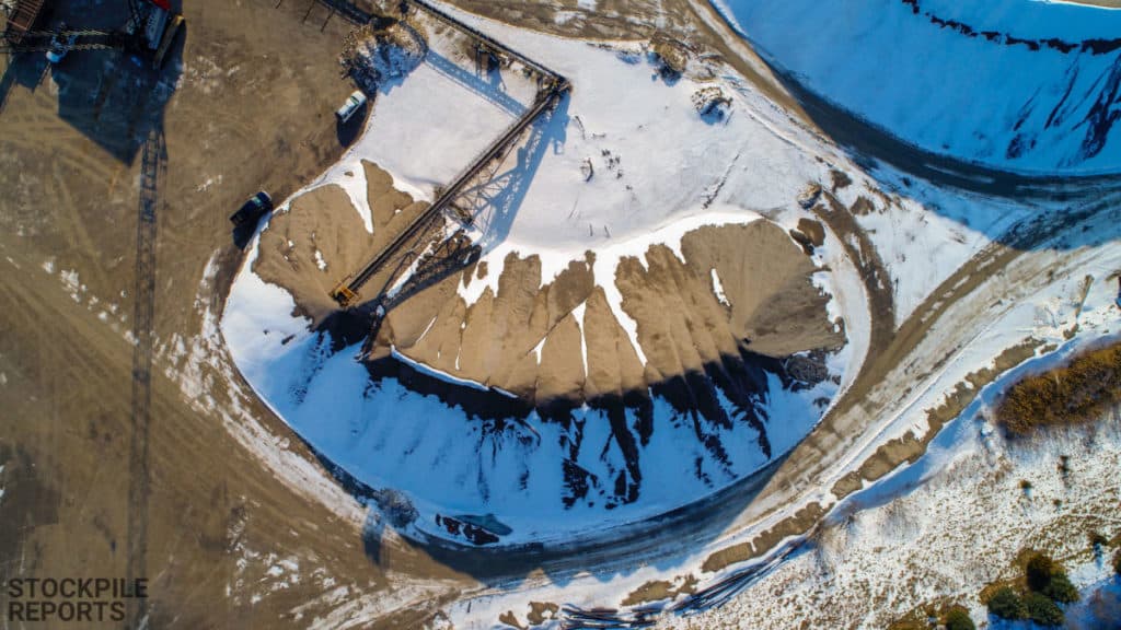
Snow on stockpiles comes in two forms: complete coverage of a stockpile or partial coverage due to snow drifts or areas that have completely melted. Each situation has similar effects on the accuracy of a measurement.
- Complete Snow Cover – Stockpile Reports’ proprietary algorithms measure the topmost material of your pile surface. The impact of the snow cover will overstate your pile volume. Depending upon the thickness of the snow coverage, this may impact your pile minimally or a lot.
- Snow Drifts/Partial Melted Snow – Snowdrifts against the side of a stockpile have the same impact as complete snow cover. Snow drifts against your stockpile will add extra material to the total. The impact on stockpiles with partially melted snow depends on the amount of exposed material, this may have marginal effects on your volume accuracy.
What Other Winter Conditions Might Affect My Measurement Plans?
The days are shorter during winter months, meaning you have less light. Also, the angle of the sun in the sky is low during most of the day. These two factors can affect your management plan in two ways:
- A shorter day means your team may not be able to measure all of your sites in your normal timeframe. Allow for extra days for your team to complete their inventory.
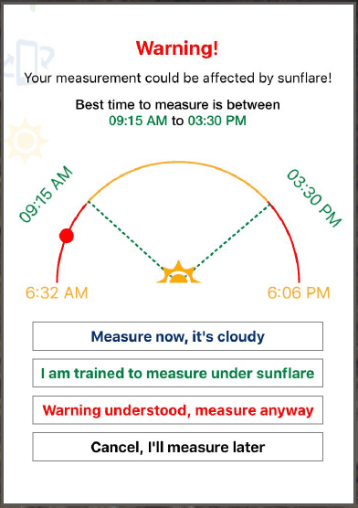
- The sun azimuth is lower during the winter months which has a potential for sun flare in your iPhone measurements. We recommend measuring as close to noon as possible. The iPhone app recommends the best time measure at your specific location.

The best practice is to have a plan and policy in place so that the decisions are clear when snow falls. This will bring greater consistency, precision and reliability to your financial statements and reduce the risk that a snow event disrupts your business reporting or becomes a resource drain trying to explain out of range results. Let us help you take control back from Mother Nature.
About Stockpile Reports
Stockpile Reports is the first vertically integrated service for logistics and inventory management of bulk materials at scale, digitizing images of bulk materials to solve problems with accurate perpetual inventory and supply chain planning. Every Pile, Any Time.
Stockpile Reports uses EveryPoint, a spatial computing platform which supports infinitely scalable data collection and processing for the next generation of spatial computing applications and services. EveryPoint has been building spatial computing solutions at scale, ranging from rapid 3D processing of massive image datasets to global logistics and inventory management solutions. Use EveryPoint to bring spatial computing to your applications and services.


